UWSP Center for Watershed Science and Education recently completed a depth mapping of McDill Pond. The following is the preliminary map:
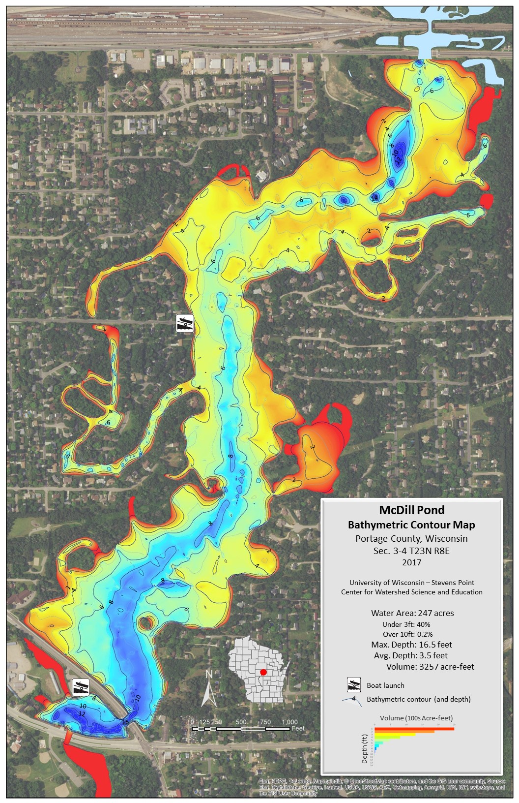
UWSP Center for Watershed Science and Education recently completed a depth mapping of McDill Pond. The following is the preliminary map: